Thursday, December 13, 2018

TF1570: Cut and Cover cheaper then elevated for RRT

Based on data compiled by Daryl Dela Cruz, cut and cover appears cheaper than elevated. I developed a spreadsheet that used this data for some calculations and was questioned about this discrepancy. My response:

You'll notice that for ALRT lines, Canada Line is the only line which used cut and cover. The others that used cut and cover were LRT and I am suspicious of their costs being higher for LRT with their typically larger train-cars and overhead AC (meaning they have to dig out substantially more than they would have to for third rail Skytrain).

However, even though Canada Line is the only line, I feel inclined to trust this data point since it's a very recent number, a very local number, and the above grade seems to be more expensive per km than the evergreen line (expected since Skytrain Marks are LIM and much lighter).

For reasons why though my guesses are:
  • Cost of concrete is high (lots of concrete needed for above grade)
  • Engineering cost is probably about the same
  • Construction speed is faster with good soil, takes up less space, and is much easier.
  • Stations are cheaper (a building on the ground is cheaper than a building in the air: you just dig a wider hole).
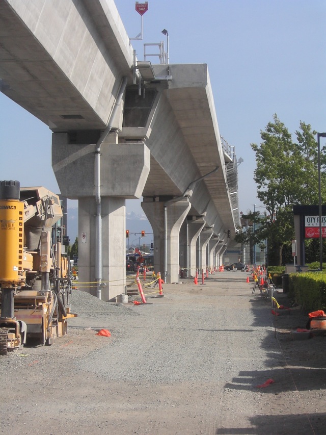
  • You end up redoing the road surface in either case (North Road got rebuilt for the above ground Evergreen Line, and No.3 and Cambie for Canada Line)
  • Don't need fancy bridge building cranes, equipment and workers.

Friday, December 7, 2018

TF1551: Metro Vancouver 50 Year RRT Expansion Plan v2

TF#1551. 2018-12-07. 

What does Metro Van look like to you in 2068? See more details via my map on Map Hub. (I got frustrated with Google MyMaps). Zoom in, see all the station names, turn lines on/off, download for youself to play with.

This is my second iteration at a 50 year plan. In this iteration I attempted to configure some of the interlining, fill some gaps, and consider commuter rail. There are definitely still details to work out, specifically around the North Shore so there will eventually be a v3.


See full size imagine here: https://i.imgur.com/z3NapIs.png

Comments:

lokyin: Priority of Hastings?
Would there be more benefit if the Hastings portion of the blue line be higher priority than 2042? It seems the route is high bus ridership already but also the redevelopment potential and higher density potential along Hastings. The car-abandonment probability is much higher along this route than suburb routes. We can densify much more of Vancouver proper (with the use of transit) spawning from expanding downtown, compared to the far off suburbs
waves:
Hastings: It's a good question. It's really hard to say. In a somewhat pessimistic but also a sad reality of building out our skytrain network in very tiny phases. In light of recent news, 2022 SFU Gondola, 2025 Expo to Fleetwood, 2024 Millennium to Arbutus (or maybe to UBC?), 2030 Expo to Langley, 2035 Millennium to UBC, 2040 Lonsdale Line or Hastings Line?

lokyin: Will Hastings and Willingdon be overcrowded?
For the north shore portion of the green line, I wonder if it's more beneficial to funnel it into the Hastings line because so much of the north shore traffic would be headed downtown, and making Hastings/Willingdon an interchange too busy unnecessarily.
waves:
Lots of North Shore transiters go downtown because getting downtown is easy. By contrast, getting from Phibbs to Millennium Line is a very slow windy infrequent bus ride (28 or 130). For example, if you are going to Metrotown mid-day from Phibbs, it is frequently more reliable and sometimes even faster to take the 210 downtown and get on the Expo Line rather than taking a direct bus. It's very slow no matter which way you go.

Car, by contrast, takes 20min typically so it's no wonder that with the North Shore's lack of housing has everyone is living in Burnaby and commuting to work in North Van by car. Translink has said that a Phibbs to Metrotown skytrain has been studied as not having enough potential ridership currently but I question how that was determined. If it was based off current ridership I would argue that with the horrendousness for bus-transit in that area, it's no wonder ridership is not growing/is not high to begin with.

I would argue that the regional connectivity connecting all of the North Shore, Brentwood, BCIT, Metrotown, and by connection Surrey would significantly increase ridership. Currently, if you are going anywhere west of Cambie on Broadway, it's faster to go downtown first. With a line to Brentwood, it'd be faster to go there and hop on a Millennium Line train (which at that point would be extended to Arbutus or UBC).

lokyin: Is downtown under-served?
Downtown looks underserved despite some new stations. Perhaps an LRT around false creek from granville island to olympic village up to gastown to waterfront station could be weaved into this plan for relatively cheap.
waves:
Downtown is actually pretty small in area. Studies have shown that 50% of people within 500m will walk to a metro station. If you look at the image below you can see that with a Hastings Extension and Lions Gate Extension you do provide really good coverage.  In addition, I don't see the usefulness of an LRT from a transportation perspective when you could accomplish the same objectives by using electric trolley buses with some transit only corridors (kind of like all the trolley buses now which use Granville St).


TF#1568. 2018-12-13

scyer: What about the hills of the North Shore for going up to 23rd Street?
I feel that the Expo extension to 23rd is a little over-kill and probably very difficult to design as it is going up a mountain.
waves:
As for whether it goes up to 23rd, there are some tall towers going up all along the Lonsdale corridor (like 20+ stories). The Lonsdale corridor up to 23rd is also designated as an urban core in Metro Vancouver's 2040 growth strategy. As for engineering difficulty, check out my last post on the Lonsdale Line where I drew out a profile showing that it can be done in under the 6% grade. I agree with you that its not very simple, but I do think it could be achievable.


Why is Arbutus LRT not on the map?

waves:
The Arbutus Corridor is only 2.5km away from the Canada Line, heck it's only a 10 min bus ride to the Canada Line. My opinion is simply that I think other regional priorities are more important.

Bdawe: Is splitting the Expo Line at Commercial-Broadway a problem?
Commercial Broadway-Downtown is the busiest segment of the expo line and is likely to always be thus. Splitting at Commercial is essentially short changing the busiest segment for peak capacity.

waves:
What if you had 1:4 ratio of North Shore : Downtown on the main Expo Line and then 1:1 ratio of Commercial-Broadway:Surrey on the Lonsdale Line?

(Essentially every 5th train north (~10min assuming 2min headways on expo) would go the Quay from Surrey, and every 2nd train south from the Quay would terminate at CB so you have 5min frequency service to CB and 10min to surrey?)

CB now has the third platform which would allow it to have that flexibility for trains to turn back to the North Shore at CB.

It is a good question though if even that sort of interlining would be too much. If we look at the graph below, we can see the modeled on/off with the Langley extension. If you tally up all the alightings up to and including CB that number is 15371. After CB is 15366. 50% of all riders travelling on the Expo Line are not going past CB - So if you were to take 20% of the line and split it to North Van would that cause problems with capacity for downtown? According to these numbers at least, my thoughts are that it wont?


If we are concerned however about maintaining the full capacity from CB to Burrard, there is a way to accomplish that goal using a 3rd track and the existing 3rd platform at CB.  5 of 6 trains will go from Langley to Burrard, 1 from Langley to North Shore, and 1 from Commercial Broadway to Burrard (which would be highly valuable considering that 4000 people need to board at CB alone). In some ways, this may actually improve the efficiency of Commercial-Broadway because it provides an empty train every 6min to provide relief for transfers coming in from the Millennium Line.

The schematic above shows the capability for maximum frequency/capacity of 75 second headways in the following directions:
  • Langley Centre to Scott Road
  • Columbia to CB [current]
  • CB to Burrard [current]
  • Hastings-Willingdon to Waterfront
In a 6 train timing cycle, 6 trains to one destination would have the capability of the Expo Line's max build-out capacity of 25,000. For a 3 train timing cycle with half the frequency of the 6 train cycle that halves the max capacity to 12,500 (which is just over double the current 6,000 capacity the Canada Line currently runs). The Seabus runs at a capacity of 1,200 pphpd right now (2 boats each with 300 person capacity @ 15 min frequencies). I think max capacity is 1,800 with 3 boats at 10min frequencies.

Migrant Coconut: Won't induced demand be an issue and 12,500pphpd not be enough?
Induced demand induces pretty fast. 15,000 is the Canada's peak, and half the city's going "no, that's not enough." Ditto the North Shore: we're not just talking about people on the SeaBus, we're talking drivers and bus passengers on both bridges, and possibly people who wouldn't ordinarily venture across the Inlet, but might now, because "hey, now there's a SkyTrain.

The recent municipal study pegs North Van residents commuting south at around 40.5k, and vice versa at 21.3k; assuming a round trip, that's 123k trips. You probably know more than most of us about how many of those trips would be switched to what kind of SkyTrain route, but AFAIK it's better to overbuild. Two separate routes also creates less points of failure for the signalling system, a more comprehensible map, and more ridership from having twice the frequency. It's an elegant solution, what you came up with, but I think the KIS principle overrules it.

waves:
I decided to look at number somewhat more carefully and did some crude math with a lot of assumptions:

(A) INSTPP Population Increase by 2041 = 61,000 ppdpd
(B) Proportion Lonsdale TOD Assumption = 60%
(C) Mode Share of pLTOD Assumption = 60%
A*B*C = (D) New Population Ridership 2041 = 18,300 ppdpd

(E) Average Seabus weekday boardings = 18,740 ppd
E/2 = (F) Average Seabus weekday boardings per direction = 9,370 ppdpd
(G) Total Transit southbound from North Shore = 40,500 ppdpd
G-F = (H) Total non-Seabus Transit southbound from North Shore = 31,130 ppdpd
(I) Skytrain Diversion Rate Assumption = 40%
H*I = (J) New Stolen Ridership = 12,452 ppdpd

(K) North Shore Mode Shift from Car to Skytrain Rate Assumption = 15%
(L) North Shore Mode Share Car 2017 Average = 72%
(M) North Shore Mode Share Transit 2017 Average = 17%
G/M*L*K = (N) 2017 Shift from Car to Skytrain Volume = 25,700 ppdpd

D+F+J+N = (O) 2042 Skytrain Daily Average Ridership = 65,800 ppdpd
O/20 = (P) 2042 Skytrain Average Weekday Hourly Volume = 3,300 pphpd

(Q) 2017 Seabus Peak Hour (8am) South Average Volume = 1150 pphpd
(R) 2017 Seabus Capacity at Peak Hour = 1540 pphpd
(S) 2017 Seabus Average Weekday Hourly Volume (20hr/day) = 450 pphpd
Q/R = (T) 2017 Seabus Peak Hour (8am) South Average Peak Load Factor = 75%
Q/S = (U) 2017 Seabus Peak Hour (8am) South Average Peak Volume Factor = 256%

P*U = (V) 2042 Skytrain Peak Hour (8am) South Average Peak Volume = 8,500 pphpd
V/T = (W) 2042 Skytrain Capacity for 2017 similar crowding levels = 11,300 pphpd

This doesn't account for what kind of increased development might happen because of the line thereby further increasing the ridership. Tack on 1,200 pphpd and you are at 100% capacity at peak hour. This is all been very liberal though to see the high estimate. (50% car to others mode share, all seabus diverted to skytrain, similar peak volume factors, ect.) All of the mode share shifts are also assumed as if the switch to skytrain happened now, and was gradual over the next 25 years. If the line is built in 2040, then you won't see that mode shift right away and you could probably get away with 12,500 pphpd capacity for 10 years while the mode share shifts, but you will need more than that for the long term of the line which means that the 4th platform at CB will likely be a necessity immediately so that service can double up to 25,000 pphpd. 

So yes, 12,500pphpd max capacity is an issue, but likely won't be for at least 10 years after completion. It will be important to have the integration with CB designed for expansion of the Lonsdale Line's maximum capacity.

The line can run completely independent between CB and 23rd. If you can run a direct train every so often from 23rd to Langley and if something goes wrong can't you just revert to the the lines acting separately? It's not quite synonymous with the Sapperton Branch since no trains run only between Production Way and Columbia.

Saturday, December 1, 2018

TF1547: Curved Metro Stations

TF#1547. 2018-12-01
fredinno: "Are there any Curved metro stations out there? It's not entirely on a curve- but it can't fit a 80m max-length platform without adding a curved station section. I would imagine the engineering and cost challenges would pretty much guarantee it only gets built after the current New Westminster Stations fill out."
New York has one: https://en.wikipedia.org/wiki/City_Hall_station_(IRT_Lexington_Avenue_Line)


Friday, November 23, 2018

TF1522: Metro Vancouver 50 Year RRT Expansion Plan v1

TF#1522. 2018-11-23. 

After my last post about the Lonsdale/Commercial Line I began to think about phasing and what a 50 year rail rapid transit expansion plan would look like.  This is what I came up with:

Metro Vancouver & Translink's 50 Year Transportation Plan

Comments

Sheba:
The main issue I have with it is all the interlining. Yeah it's a nice idea to give people a one-seat ride but it's not very practical (it's come up on here before). Your green Lonsdale Line would easily work as a separate L Line in Surrey and then another separate line across to the North Shore. Also it doesn't all need to be Skytrain - some of the lines make more sense as commuter rail or even B Lines.
waves:
This is fair criticism and something I will try to address in my next iteration.
trofirhen:
I really like it!!! Some of it will be in the very long-term, but I think the Langley/Willowbrook /Guildford line might be next up, along with the UBC extension (perhaps top priority). The line to kerrisdale is a great idea. Under the harbour to Lonsdale and up would be my choice for then next leg. The rest, in due course, but that's just my take on it. Oh, and make the SEABUS every 10 minutes most of the day. The time frame you have posted seems reasonable and realistic, IMO. One last reservation though. I really think more and higher frequency suburban commuter rail would be better out to Maple Ridge, also through Delta to Willowbrook and on to Abbotsford, if possible.

fredinno:
Uhh... I think you're putting too much emphasis on the North Shore here...  But really, there's a lot of decent ideas here. I have a problem with the Kerrisdale Line though- people using it are largely people going to UBC as well. Which is why the B-line is supposed to go all the way there. Also, no way to get to PNE on Skytrain

CanSpice:
That line that goes through Delta is, and I'm sorry to be blunt, terrible. And a Kerrisdale line but nothing along Marine Drive? And SkyTrain to the ferries will probably never happen because it's just not a good idea. It's all fine and good drawing lines on a map but they should really bear some resemblance to reality.
waves:
At Grade in the middle of a highway? Doesn't seem like such a terrible idea to move people a long distance for cheap.

Marine Drive has development along only one side of it. Doesn't even have an express bus on it. The part through Burnaby is also agriculture with spotted commercial. Why should it get Skytrain?
fredinno:
It's not all along Hwy 10/99 median- plus, it'll still have to be elevated as it goes into populated area.

Marine Drive would be ok for Commuter Rail, though. Bonus points if you can get it onto Arbutus and upgrade the New Westminister Bridge.


Thursday, November 8, 2018

TF1491: The Lonsdale-Commercial Skytrain Line

TF#1491. 2018-11-08

I was contemplating the idea of a twist and turn to get up Lonsdale with Skytrain and I wondered, well, how much can I shorten that twist and turn and at the same time stay below 6% grade? I plotted out a route and then created a profile. I assumed the line would stay 20m below the ocean floor and then planned it outwards from there trying to keep the stations as close to the ground as possible and the slope at 5.8% or less.

The solution I came out with actually seemed to reasonably work and not be overly crazy in terms of cost ($2.53 billion in 2018 Canadian). There are many benefits for going with such an alignment:
  • Connects to Commercial-Broadway Station which is like the epi-center of transit in Metro Vancouver.
  • Commercial-Broadway now has a third platform which would be easy to tie the new line into
  • Lonsdale Quay to Commercial-Broadway in 10min. Surrey Center or Coquitlam Center in 40min. (For both Driving takes 30min without traffic!). 
  • Delivers transit to the Lonsdale Corridor which has the highest density on the north shore. 
  • Makes connecting to the Seabus much faster. From 23rd to the Quay in 5min (versus now by bus, 15-20min).
  • The "snake" curve alignment up Chesterfield and St. Georges allows for 3rd St to have a station aligned East-West. This would be brilliant for the future where a North Shore East-West Skytrain Line could connect directly to that 3rd St. Station. You could also get on a train at 23rd and continue straight to Park Royal without switching trains, or get on at Commercial Broadway and continue straight through to Phibbs and Dollarton. There are lots of options with this.


Comments

waves: Commercial/Victoria is 3rd in Bus Ridership in Vancouver!
Also saw in the Arbutus Thread that Commercial/Victoria is the third busiest bus route in Vancouver (1st is 99, 2nd is 41). With connection to the North Shore, that Commericial Corridor has a very high ridership potential.
Daily Hive Quote:
"Top 10 busiest bus routes in Metro Vancouver in 2016 Based on annual boardings (operating cost per boarded passenger):
  • 99 UBC/Broadway Station B-Line: 17,288,000 boardings ($0.60 per passenger)
  • 41 Joyce Station/Crown/UBC: 9,019,000 boardings ($0.94 per passenger)
  • 20 Victoria/Downtown: 8,371,000 boardings ($0.93 per passenger)
  • 49 Metrotown Station/Dunbar/UBC: 7,506,000 boardings ($0.87 per passenger)
  • 25 Brentwood Station/UBC: 7,409,000 boardings ($1.07 per passenger)
  • 16 29th Avenue Station/Arbutus: 7,200,000 boardings ($1.19 per passenger)
  • 9 Boundary/Broadway Station/Granville/Alma: 7,137,000 boardings ($1.12 per passenger)
  • 135 Burrard Station/SFU: 6,513,000 boardings ($1.08 per passenger)
  • 3 Marine Drive Station/Main/Downtown: 6,249,000 boardings ($1.01 per passenger)
  • 106 Metrotown Station/New Westminster Station: 5,948,000 boardings ($0.94 per passenger)"
Migrant Coconut: And it outperforms San Fran!
Fun fact: all of the top ten outperform San Fran's entire cable car network.
Migrant Coconut: Extension further down Victoria?
Could a Phase 2 extension could get past the Expo and head south down Victoria? Seems like a waste to leave it at Broadway.
waves: It is possible but is it reasonable?
You could yes. To complete your alignment below from Victoria to Bridgehouse. So at $114 million per km above grade (11.4km), $270 million per km bridge (1.0km), $30 million per station (8), you result in $1.81 billion (2015 dollars) to complete that southern portion. If you only went to Marine Drive, it would be only $800 million (6km, 3-4 stations).

Most North Shore commuters don't really travel to the Fraserview area, so I guess I am just wondering what the point would be? With that in mind I am imagining that a number of potential projects might get priority namely: Hastings Skytrain Line, 41st/49th Skytrain Line, PoCo Extension, Canada Line Extension. Thoughts?
Migrant Cocnut: Maybe only to 41st?
Fair point - maybe to 41st/49th only. I was thinking that the Bridgeport switch will bottleneck sometime down the road, and that we need to give each of the branches its own line. I dunno about that order. The North Shore is practically screaming for the next SkyTrain (understandably so), and TransLink just might give it to them.
waves: List of regional priorities for capital transit projects
Oh the list wasn't complete or in any order. I have no idea what should come next. Right now as far as I can see things politically, in order:
  1. Langely Skytrain Extension + SNG-White Rock BRT.
  2. UBC Skytrain Extension
  3. SFU Gondola
  4. Something for the North Shore, idk what
  5. Canada Line Reno's and Extension (3 car trains, 50m long platforms, extension to Ladner)
If the line goes to 49th, that would be 4km and 2 stations, so $500 million extra. I'll look at specific phasing in a future post.

freddino: What about an Interurban alignment?
Would it be better to have the North Shore Line use the old Interurban ROW via Strathcona? It wouldn't have to be bored all the way, and there IS a somewhat deep section on the path that might screw things up. See the alignment in purple below. Somewhat longer and deeper line in Burrard Inlet and less development opportunity around the line, but, it is in exchange for a cheaper alignment through Vancouver that can use an abandoned port as the tunnel port thus reducing costs and giving a staging area for the project (the port was originally for BC cruise ships, but was abandoned, I forgot its name). Also, maybe less severe turns at Lonsdale Quay.

Interurban Alignment Option (in purple)
Migrant Coconut: But you would miss the activeness of Commercial,
But then you're skipping the most active part of Commercial and most of Grandview-Woodland. The purple alignment has a couple of bars and restaurants, Fujiya, an elementary school and a really good gelato place, and that's about it - the rest is light industrial.

waves: Sure, but you would need to dive into a Bored Tunnel early there too.
fredinno, I have thought about that route too. The issue with it technically is that the inlet is deeper there. For the alignment in green, the bored tunnel must start at 1st avenue in order to get it deep enough (supposedly*) under the ocean floor. If we were to go with your route, you would have to do about the same (meaning the majority of that section has to be bored tunnel anyways and can't be at grade). Migrant Coconut also makes good arguments from a planning perspective.

Also, about the curve at the Quay on to Chesterfield, you might be able to have the line turn eastward sooner and follow that ridge before turning north-east straight up Chesterfield.

*I say supposedly because I am not a geologist and I haven't seen the stratigraphy along the route. This publication has some good information.
Jasoncw: Source for your cost?
Do you have a source for this breakdown? Your Lonsdale Line is wonderful.
freddino: The numbers look the same as Broadway!
Yeah, I have no idea how he came to that number for the Lonsdale Line when Broadway is $2.8B. The bored section of Broadway is close to the same length as just the Lonsdale Line Segment all the way up. (+ - 0.1km) [unless he plans on Cut-and Cover- which would be impractical due to high densities in the region] , includes a bored tunnel though East Vancouver, and a tunnel into Burrard Inlet, and is LESS than the Broadway Extension? I don't buy it.
Migrant Coconut: Property values are increasing the Broadway cost.
Two words: property values. Right now, Broadway is practically part of downtown, and even a Denny's or IHOP sells for over $20M; the estimate for the subway was $1.9B just last year.

The Canada Line cost about $2B ($2.3B in 2018 CAD) in part because it went through pre-density suburban and demiurban areas; even if Commercial is higher because of TBM costs, we're not going to see one of the LRT shills' moronic $3B+ figures.
waves: Estimate methodology is based off other North American transit projects.
The estimates do not include property acquisition costs, as MC correctly noted. 
My secondary source for the cost numbers stem from Daryl's Blog post here. If he's reading this and has a newer post out I would be interested to see it. If you want to take a closer look at my calcs you can follow along in my crude spreadsheet here

I took Daryl's spreadsheet and expanded it out to include km of each grade type then used Excel Solver to minimize an RSS. 
So, now the questions is, which lines in the table can we use? It's a good question. I had been using the "Only BC" numbers since my RSS results were the lowest, and most Vancouver related anyways. The table (shown above) however shows the range of $mill/km values you can get and the cost estimate associated with each assumption.

The Option 2 for the Langley Extension is based off of the map from Global BC here at about 55 sec. Technically there is about 9km of At-Grade described in the map, but I reduced that to 8km for an overpass at Hwy 15.

Also fredinno, Cut and Cover for 13th to 23rd for the Lonsdale Line is suggested on the profile.
fredinno:
I'd be iffy on Cut-and-cover on 13-17th; it's just too dense yet to start cutting up the road. Starting the cut on 17th avoids the remaining skyscrapers
waves:
Just because there are taller buildings beside the road doesn't mean that you can't have cut & cover in the road. Buildings don't go under roads typically and the ones on Lonsdale are not atypical. I stand by the ability to use cut and cover from 13th upwards.

Sheba:
Here are a couple other ideas for getting Skytrain to the North Shore (I'll leave the NS route / stops to people who know the area better than I do).
  1. A Willingdon Line from Metrotown, past BCIT and Brentwood to Kootenay Loop and then a bridge next to the Iron Workers Bridge to Phibbs Exchange and beyond
  2. A Hastings Line starting at Kootenay Loop to downtown Van, through Stanley Park and then a bridge next to Lions Gate Bridge and east to Lonsdale Quay and beyond
Migrant Coconut:
Can't find the study itself, but the findings are that a Downtown-Lonsdale crossing gets the most ridership.

GMD:
Ideally, these could connect as part of a single line (which would cross itself around Kootenay Loop - Hastings/Willingdon), which would of course, then extend from Metrotown, west along 41st and up to UBC... in my transit fantasy I refer to this as the 'Sea to Sky Line' (starting at the sea in UBC, and ending, via Gondola from Hastings/Duthie in the sky at SFU)

fredinno:
The issue is that there's not a whole lot in terms of dense development on the other side of 2nd Narrows, and it wouldn't replace the Seabus. Getting as close to Waterfront-Lonsdale as economically possible is the way to go here.


Sunday, September 9, 2018

TF1470: Skytrain under SFU from Hastings to Port Moody? Max Skytrain Grade?

TF#1470. 2018-09-17

If there was ever a realm where a Hastings SkyTrain line was constructed and it was desired to connect directly to SFU how would it happen? Here some ideas:

Bored Tunnel and At-Grade Alignment Suggestions
Sketch of a Bored Tunnel Station for SFU

Comments

Sheba: The grade is too steep!
We can't have a rail line go up Burnaby Mountain to SFU as the grade is too steep - it's why they're proposing a gondola.

Unregistered User: What about an elevator?
I envisioned a very expensive bored tunnel with an express elevator similar to Beacon Hill Station in Seattle.
waves: Not very elegant, but they do exist.
A super fast elevator could work, but it's not very elegant. London has a few stations with express elevators and they feel like the Tower of Terror at Disney Land Orlando.

waves: An 8% Bored Tunnel would get you 1 station at a 10m depth.
If you put the line at an 8% grade starting at Dalla-Tina Ave you could get a station depth of 10m at the current bus loop or an 18 sec escalator ride. 8% is really pushing the grade to the max though. You would only get the one station though. Putting a second station at Univercity would not be practical as you would immediately need to begin descending to connect back to the evergreen line at the same 8% max grade.
Sheba: Max grade is 6% though. Maybe just terminate at Kootenay Loop?
They've [Translink?] already stated a maximum 6% grade so up Burnaby Mountain and back down again is a no go, and unless they decided to build a north - south line waaaay east of Willingdon there's no real terminus in Burnaby. We're better off terminating it at an enlarged Kootenay Loop.
waves: Why the 6% limit when theoretical is higher?
From what I understand the theoretical maximum of the LIM motors is 10% but because of snow and possibly comfort they limit it to 6%. I wonder however, if an exception would be considered if the grade were to be in a bored tunnel where you don't get snow and rain on the rails and people on the train won't likely notice the steepness of the grade because they lack a horizon outside of the train (similar to how an aircraft without IFR goes VFR into IMC).

I did some calcs on what the escalators would have to be in order for the grade to be 6%:
  • 6.0% Skytrain Grade = 62 m station depth at Univercity Plaza = 108 m escalator length = 3.5 min standing on escalator
  • 6.5% = 50 m depth = 86 m escalator = 2.9 min
  • 7.0% = 37 m depth = 64 m escalator = 2.1 min
  • 7.5% = 24 m depth = 41 m escalator = 1.4 min
  • 8.0% = 10 m depth = 18 m escalator = 36 sec

The likely cost of going this straight line route alone would be likely be about 2.5 billion so its of course not going to happen anytime soon, or ever, particularly if the Gondola is still an option.

I think a more likely scenario if SkyTrain were to ever reach SFU would be for it to follow up the Parkway from Hastings at a 7% grade. Some cut and cover excavation would be needed higher up but it is possible. It would make a nice connection to be able to go up the gondola from Production Way then transfer on to the Hastings Line right at SFU. Also since half of it would be at grade, there isn't much land to expropriate, and, because cut and cover is significantly simpler, cheaper and faster than bored tunnels, the 3km track up from Hastings could be significantly cheaper. If we assume that the project costs about the same as the Evergreen Line, then the whole 12km from Downtown to SFU would be about 1.5 billion in 2016 dollars which is not totally bonkers.
Migrant Coconut: World record escalator length!
And on top of that, an 86m-long escalator gets us into the Top 10 in the Guinness Book of World Records. Win-win for everybody!
waves: At-grade alignment at 7% would be more reasonable for escalator length.
If you went up beside the parkway at 7% rather than a straight line bored tunnel the station depth would be 15m and so the escalator would be a more reasonable 27m rather than 64m.


Tuesday, October 17, 2017

CL528: Double tracking the Canada Line to Brighouse

CL#528. 2017-10-17

I took a look at just "how hamstrung Brighouse is" and I drew up a sketch for a potential station. It seems there is ample space for the second track pretty much all the way up to the station with the exception of the very end where the building is in the way. We have a few options.
  1. Double track almost all the way up to the station. (cars wouldn't have to wait at Landsdown to leave for Brighouse).
  2. Double track to the station, then rebuild the station as a stacked station.
  3. Double track to the station and switch over the current brighouse platform to NB only. Create new SB platform that is accessed from the other side of the street. (shown below)
New Southbound Tracks, Platform and Concourse for the Canada Line at Brighouse Station

Comments

Migrant Coconut: Option 3 reduces half the foot traffic at street level!
I very much like Option 3. Creative, and since most Brighouse commuters are headed to the mall anyway, it reduces half the foot traffic at the pedestrian crossing!

roger1818: Option 1 is good enough but any double tracking would be disruptive.
I suspect option 1 is good enough considering the line is split anyway, so the Richmond leg won't be at maximum capacity. Even if they have more trains going to Richmond than the Airport, they could still have the trains leave Brighouse at even intervals (to avoid a bottleneck) and adjust the speed and dwell times of the trains to feather them in with the trains from YVR. Regardless, double tracking would be highly disruptive.

dleung: Note that the original decision to single track was political not financial.
We should recall that the decision to single track to Brighouse wasn't because of budget issue. Double track was originally intended, but the geriatrics at Richmond city council didn't like the heavy guideway ruining the quaint arterial that is No 3 Road, and wanted an at-grade LRT, but settled on single-track for less "visual impact".

officedweller: Columns would need rebuilding. Would need to use Lansdowne as a temporary terminus station.
Factors to consider:
Single to Double Tracks at Lansdowne
  • The columns for the single guideway are smaller (guideway could also be rebuilt as a lighter steel box girder):
  • availability of clearance and RoW space at the existing station for horizontal expansion to fit a new platform
  • new platform wouldn't need to be a centre platform, as it would no longer be a terminus station (assuming expansion tied to southern extension)
  • rebuilding in place would depend on feasibility of using Lansdowne as a temporary terminus station (i.e. if Lansdowne mall redeveloped in the interim, there may be no room for temporary bus bays)
Single track guideway and columns north of Richmond-Brighouse Station
waves: Are the columns the same diameter?
The columns look like they have the same diameter up until the top piece which is bigger for the dual track. Is this just the photos deceiving me? How much smaller in diameter are the single track ones? Interesting idea to use steel to reduce the weight. It's too bad the rotem trains are a lot heavier than the LIM skytrains.
officedweller: They are slightly narrower,
Yeah, come to think of it, the steel box girders may all be on the SkyTrain Lines, not the Canada Line. I think the shaft of the single columns may be a bit narrower.

officedweller: A median "Brentwood" like station could be a solution.
If the solution is a median station instead of rebuilding in place, it would need to have a mezzanine - i.e. taller guideway, but if new guideway is all the way from Lansdowne, could be doable. Platforms for a new median station could be cantilevered over the roadway - like at Brentwood Station. This would requiring only fat columns to support the whole station structure.  Overpass supports to the mezzanine would land on opposite sidewalks. A dual guideway would need to be located in the centre median of No. 3 Rd. Temporary terminus could be established at Lansdowne while the project is completed.
cornholio: Might be very faster and cheaper for this solution.
I assume that would be the simplest and cheapest solution. officedwellers ideas would shorten any rebuild if new columns were cast before the old guide-way was taken down. I assume if the columns are in place you could probably take down the old guideway and put up the new one in less then a month. Then the question is what you do with the station, rebuild it as well or do a patch job...the station is the difficult and time consuming part (unless you build a new one on the west side or center of the road).

cganuelas1995: It would eliminate all street level pedestrian movements.
For Option 3 by waves, you'd have to take into account that if a passenger were to enter on the wrong platform, they would have to tap out, cross the street, then tap in again. A center platform would eliminate that.
ryanmaccdn: The trade-off is that center platform have lower capacity.
Keep in mind however that center platforms however have significantly reduced capacity comparatively.
waves: Seems like a shame/waste to demolish the existing station.
As much as I think the station being in the middle of No.3 would have been a good idea if Richmond-Brighouse didn't exist, why would they bother demolishing the old station when they can just add on to it and meet the objectives just the same?
Migrant Coconut: This. If it ain't broke, don't demolish it. 
Plus the fact that the median is nowhere near big enough to fit a station. Having a platform on either end of the street works just fine in most cities; nothing that proper signage, basic observation, or just plain old asking for directions can't fix.
dleung: Terminus stations are usually center platformed for operation flexibility.
Terminus stations are always center platform because passengers can board the next train whichever side it arrives in. It should've been the case for Brighouse, but now, doubletracking with a switch just before the station is the only bandaid solution now that the station can't expand east due to new development.
Dave2: But what about King George and VCC-Clark?
Huh? King George and VCC-Clark are terminus stations with side platforms.
waves: They are only temporary terminus in lieu of final system build out.
King George and VCC-Clark were never intended as the final terminus stations. They were built with extending to UBC and to Langley in mind.

dleung: Ok, but how do they work in the meantime?
For those platforms, how do people know which platform to go up to? Is one of the platforms permanently closed? Or are there signs at the ground level concourse directing people towards one set of stair/escalators, while only arriving passengers use the other platform?
dpogue: One platform is only inbound only and the other is outbound (and sometimes inbound).
The track layout around VCC-Clark looks like this:

At the concourse level, the signage for VCC Inbound says Do Not Enter. That platform generally only ever used for offloading trains.

Sometimes when trains are running behind schedule or when they are doing staff training exercises, trains will be crossed over in front of the station, so the train arrives on the outbound platform for both unloading and loading.

The same sort of pattern (with almost identical switches) exists at Waterfront, and also applies to King George (but with inbound/outbound reversed).


SFPR64: New designs for Nordel and Hwy 91 are very similar functionally

SFPR#64. 2020-02-18.  New designs were published for the Hwy 91 and Nordel interchange. And some were lamenting the old designs. However, ...